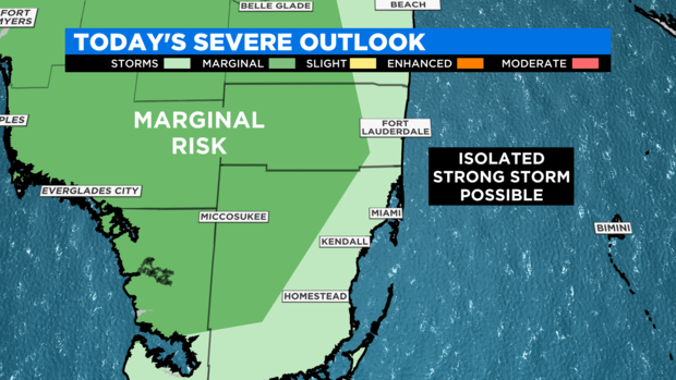
MIAMI – Afternoon storms will impact South Florida this Sunday starting at 1 p.m. Most storms will impact cities just west of I-95 in Broward and Miami-Dade.
There is a marginal risk for severe storms this Sunday afternoon for the southwest coast of Florida and over the Everglades.
But an isolated strong to severe storm cannot be ruled out in our areas of South Florida. The main threats with Sunday’s afternoon storms are excessive lightning and strong wind gusts while the flooding threat remains low.
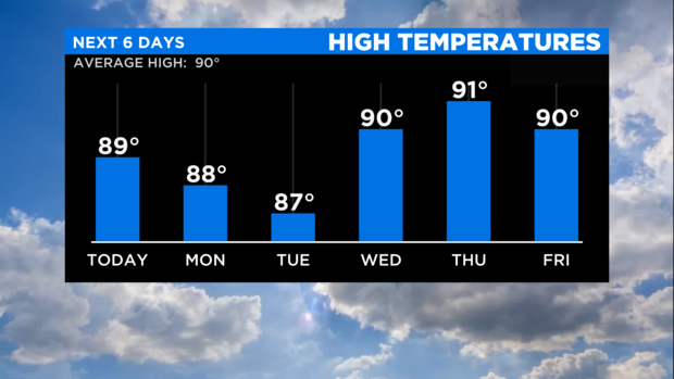
Expect typical afternoon storms Monday and Tuesday with afternoon high temperatures in the upper 80s.
Then a bit of Saharan Dust moves into South Florida’s atmosphere by Wednesday. This will drop the storm chance not just on Wednesday but also Thursday.
In return of drier air, sweltering also make a comeback by mid-week. The forecast high temperatures heat up the low 90s on Wednesday and Thursday with a sweltering heat index up to the triple digits across South Florida.

